- Insights This article was written by a TIA community member. Insights pieces undergo the same rigorous editorial process that newsroom-produced articles have.
 Rodolfo De Guzman · · 5 min read
We built a machine learning model that can estimate property values in Singapore
Estimating a property’s value can be a tricky business. You could look at its features (size, year built, or available amenities), compile the neighborhood’s statistics (population or median household income), or monitor economic indicators of the country’s housing market. But this leaves out what all property investors know is the most crucial driver of value: location.
Put a Starbucks or a high-end hotel nearby, and our intuition tells us this could increase the demand for the surrounding area. However, placing a multimillion-dollar bet on a property is risky, and investors want to base their decisions on data.
Luckily, we now have a wealth of geospatial data at our fingertips. Nontraditional sources like OpenStreetMap, social media activity, and satellite imagery provide up-to-date, granular data that can be powerful predictors of property value.
The challenge is then to sift through the millions of data points available to find what matters most and use these to identify potentially profitable investments.
Finding property hotspots with machine learning
Using a machine learning model that we built on open-source geospatial features, we were able to predict Singapore real estate prices with 87% accuracy (i.e., within an error margin of S$100). Additionally, we could use the model to estimate the price per square foot across the city-state by looking at property features such as the distance to major roads and points of interest (POIs) like restaurants and hotels.
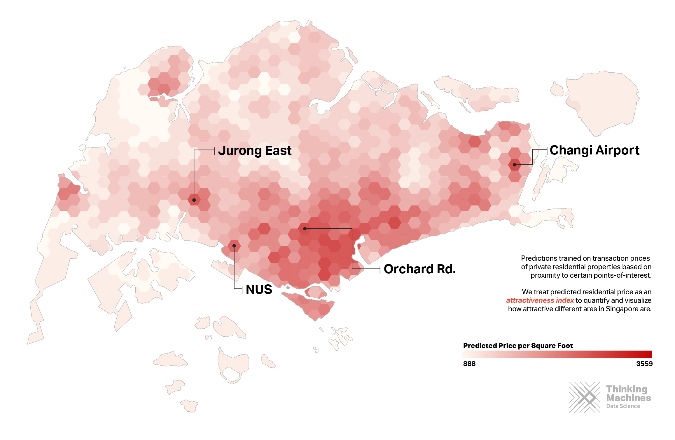
Photo credit: Thinking Machines
Grabbing data from the Urban Redevelopment Authority of Singapore’s open listing of apartment and condominium sales over the last four years, we compiled a dataset showing the locations and unit price per square foot for over 50,000 transactions.
We then used OpenStreetMap to find available POIs in Singapore. These include night clubs, train stations, traffic signals, and road types. With the help of Geomancer, an open-source library for geospatial features that we created in-house, we transformed the points of interest into quantifiable features, such as the distance to the nearest taxi stop or the number of restaurants within a 1 kilometer radius.
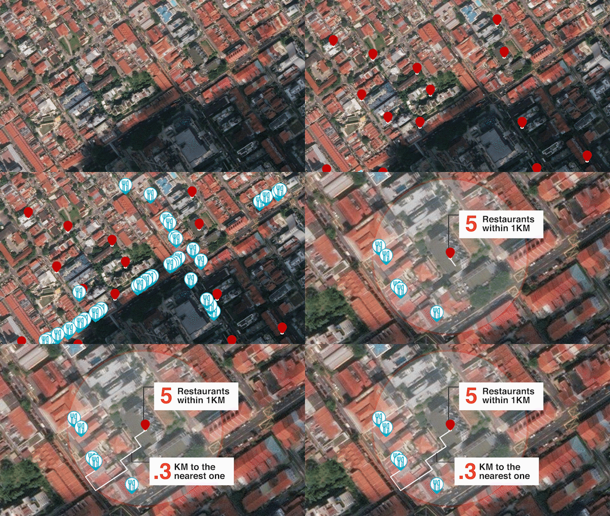
Photo credit: Thinking Machines
After splitting the dataset and setting aside 30% of the listings for testing, we used the remaining 70% of the properties and their geospatial features to build the machine learning model. Some of the features with the greatest predictive power included: the postal district and the distance to the nearest hotel and the nearest primary road.
For example, compare the features of luxury apartment Boulevard Vue, which is right off Orchard Road, to the D’Leedon apartment complex near Farrer Road:
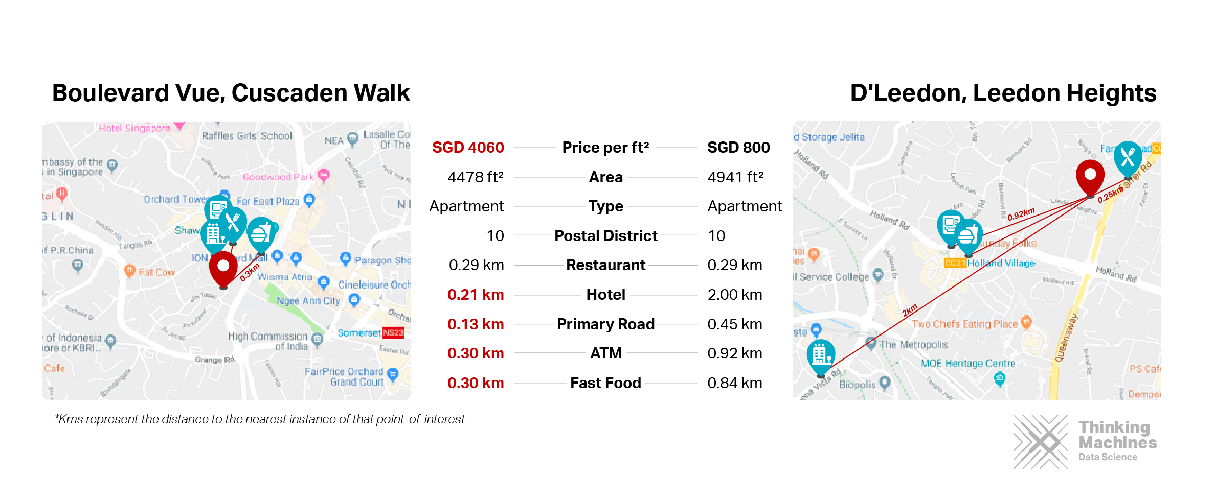
Photo credit: Thinking Machines
Model performance and features
Potential impact





Stay updated on the go with our mobile app.
Get latest insights with smoother, more personalized experience through TIA mobile app.